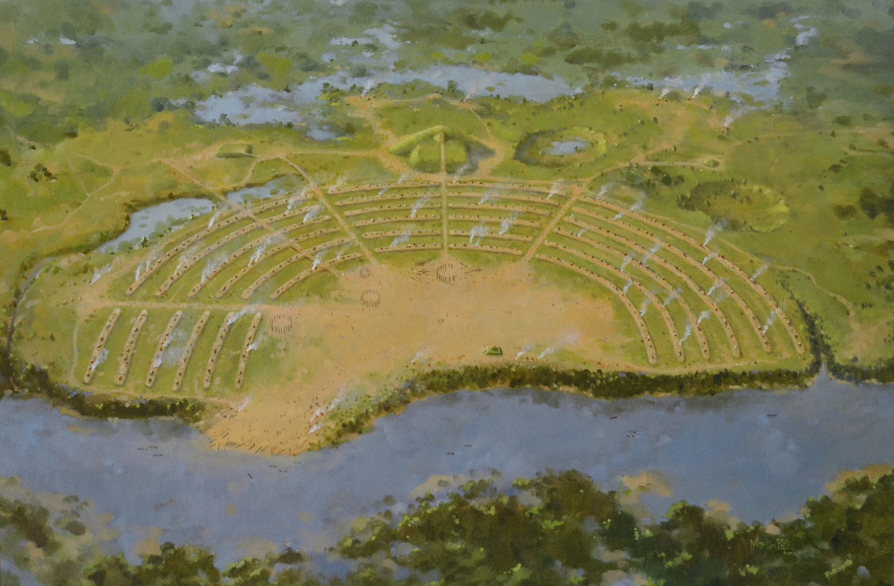
Above image: an artist’s reconstruction of Poverty Point circa 1200 BCE. Image by Martin Pate, courtesy of the Louisiana Office of State Parks.
This story appeared in the April issue of PRC’s Preservation in Print magazine. Interested in getting more preservation stories like this delivered to your door nine times a year? Become a member of the PRC for a subscription!
By Diana M. Greenlee, Poverty Point Station Archaeologist, University of Louisiana Monroe; and Rinita A. Dalan, Professor Emerita, Minnesota State University Moorhead.
The Poverty Point World Heritage Site in West Carroll Parish is renowned for its earthworks and unique material culture. American Indians built and occupied the site from about 1700 to 1100 BCE. During that time, they constructed five earthen mounds and six large, C-shaped earthen ridges. Another culture added a sixth mound more than 1,500 years later.
Because stone for tools and ornaments was not locally available, people brought many tons of rock and ore to the site from sources across the mid-South. Residents also made numerous fired artifacts from the local soil. Astoundingly, the community that built these earthworks subsisted, not by farming, but by hunting wild game, fishing and gathering wild plants. While archaeologists have studied this remarkable site for decades, there is still much to learn.
Poverty Point’s C-shaped ridges encircle a 43-acre area known as the plaza. Compared to the earthen architecture that surrounds it, the relatively flat plaza is not impressive, except for its size. Beneath the surface, though, lies evidence that it is a complex and remarkable feature, an extraordinary construction for its time and place.
Archaeologists used to think of plazas as “empty ground,” places for social activities but with few artifacts and little evidence of construction. Previous research at Poverty Point, however, has found that large areas of the original ground surface in the plaza are missing — stripped away, purposely and/or through erosion. Gullies formed along the eastern edge of the site. People then added up to 3.3 feet of dirt, and more in the gullies, to level and raise the ground surface. The plaza isn’t a recognizable earthwork like the mounds and ridges, but creating it clearly required immense effort.
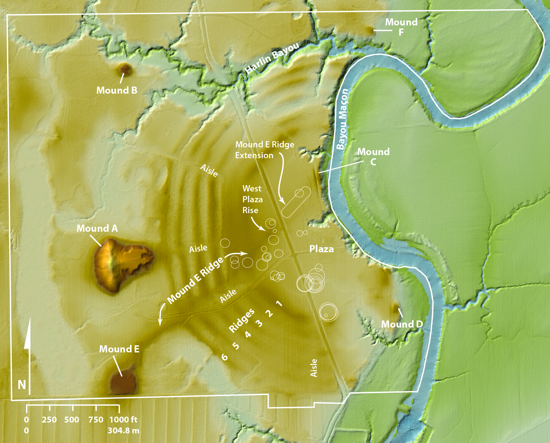
A map of the Poverty Point World Heritage Site, showing the locations of earthworks, timber circles and the buried extension of the Mound E Ridge. Timber circle data provided by Michael Hargrave and Berle Clay.
Our research team of archaeologists and soil scientists (Thurman Allen, Berle Clay, Rinita Dalan, Rachel Stout Evans, Diana Greenlee, Michael Hargrave and Arne Anderson Stamnes) is using a combination of geophysical survey techniques, targeted excavations and soil cores to further reveal the hidden secrets of the Poverty Point plaza.
The geophysical surveys have mapped traces of timber circles beneath and within the plaza fill. People placed large, probably cypress, posts in circles, which ranged in size from 16 to 203 feet in diameter. Our excavations show that these posts were removed, and the holes were refilled with soil before new posts were placed, often in the same area. We have identified 36 of these timber circles so far. Radiocarbon dates suggest the construction and deconstruction of timber circles was a long-standing tradition, spanning hundreds of years. We do not yet know their purpose.
Advertisement

The West Plaza Rise is a subtle high spot near the center of the plaza. It is about 3.3 feet higher than the surrounding ground and about 165 feet in diameter. We found that it is not a natural rise, nor is it a distinct mound. The West Plaza Rise is part of the larger earthmoving effort that created the relatively level plaza. It stands taller because the builders purposely piled more fill dirt there. It is near timber circles, and it is at the junction of two other features: an aisle that goes through the ridges to Mound A and an elevated ridge (the “Mound E Ridge”) that extends into the plaza from Mound E. We believe that location was a place of importance.
Our research has also revealed an underground extension of the Mound E Ridge that stretches across the eastern plaza toward Mound C. This ridge is not obvious at the current ground surface. People created it by removing more soil from both sides, leaving a higher “spine” of ground. Later, the builders masked the ridge when they covered the area with fill.
Particularly intriguing are two buried mound-like features that do not rise above the current plaza surface. The larger one measures about 72 by 56 feet in diameter and about 2 feet in height. It lies under about 2.3 feet of plaza fill. Our analyses confirm that its soil differs greatly from the adjacent plaza soil. Like the West Plaza Rise, it is in close association with timber circles. The smaller feature is about 30 by 36 feet in diameter and about 1.3 feet in height, buried under about 1.65 feet of plaza fill.
Together our findings point to a much more complex history for the plaza than simply raising and levelling a uniform surface. They provide a window into previously hidden uses of a very public space. They also show the value of using multiple complimentary methods to explore sometimes subtle, but significant, traces of past activity at Poverty Point.
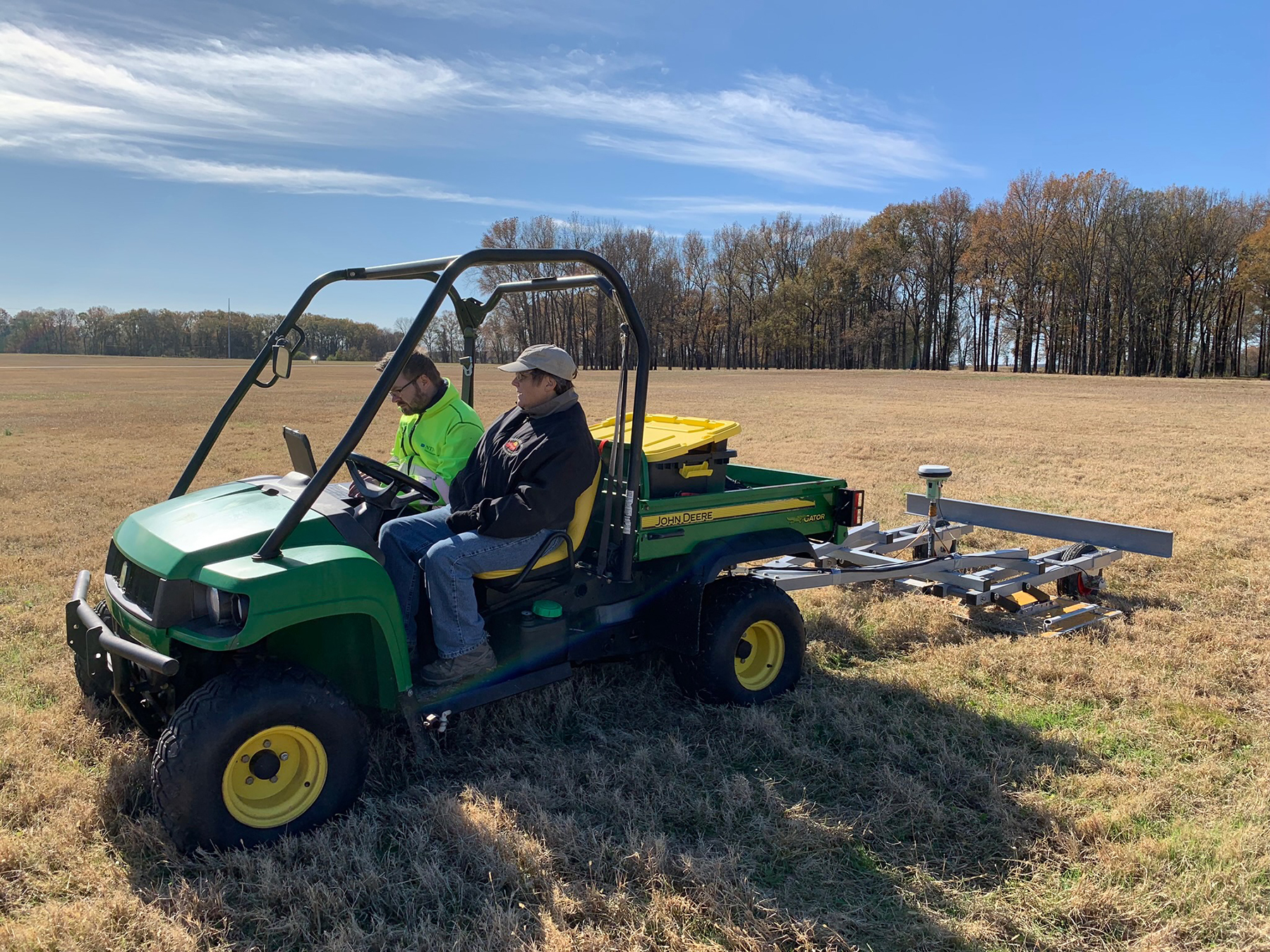
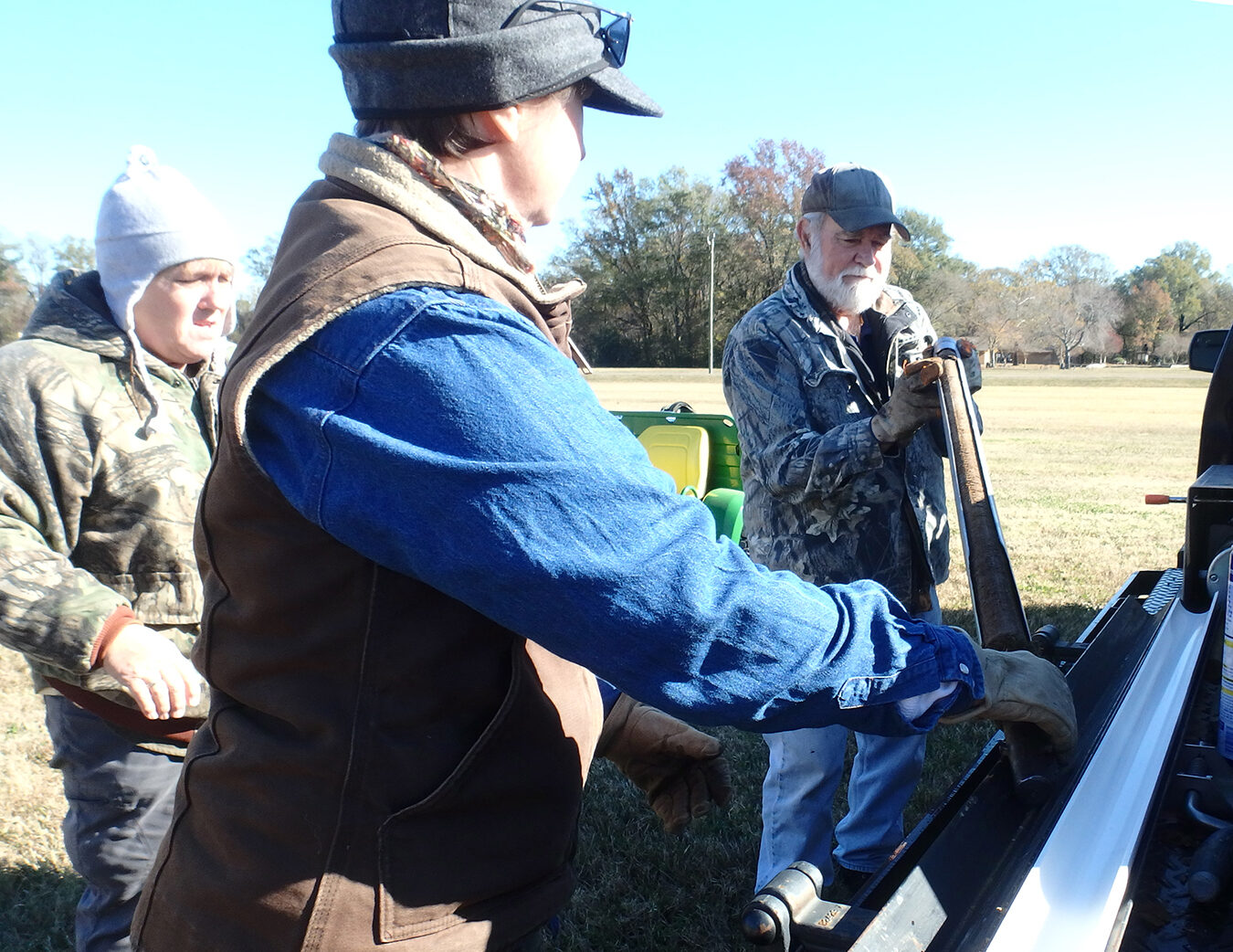
1: Arne Anderson Stamnes, left, and Diana Greenlee, right, check out data recorded by the multi-channel ground penetrating radar. This survey was supported by the National Center for Preservation Technology and Training. 2: From left, Alisha Wright, Rachel Stout Evans and Thurman Allen with a soil core taken from the plaza.

Advertisements