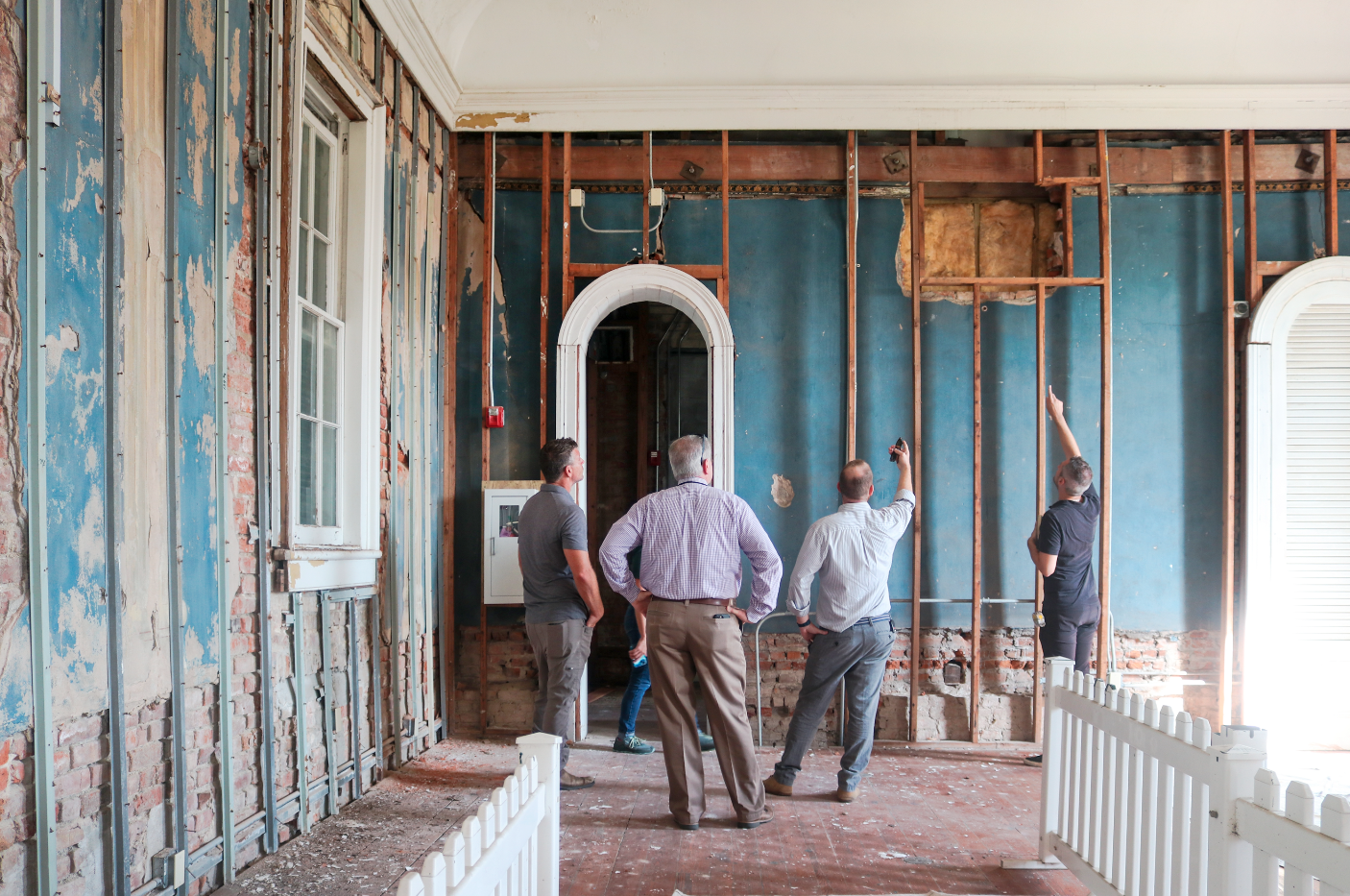


This story appeared in the October/November issue of PRC’s Preservation in Print magazine. Interested in getting more preservation stories like this delivered to your door? Become a member of the PRC for a subscription!
Where the preservationist argument falls short, historical reconstruction can mitigate the loss. The 1916 razing of the French Quarter’s famed St. Louis Exchange Hotel (1842), for example, was irreparable, but a fine reconstruction, designed by Samuel Wilson for the Royal Orleans Hotel (1960), has succeeded in reviving its legacy. Likewise, when the circa-1796 Orue-Pontalba House teetered on the verge of collapse, Wilson’s partner Richard Koch designed an outstanding replica, rebuilt in 1963 and now home to Le Petit Theater and Tableau Restaurant.
Historical reconstruction is particularly effective when it reactivates a prominent location. One example is Fort Condé in Mobile, Ala., originally built in 1723, long since disappeared, and reconstructed in 1976. The recreated garrisons’ cross-timbered walls and distinctive roof profile are particularly striking because they sit atop the entrance of the Interstate-10 tunnel beneath Mobile Bay. Cross-country motorists thus gain a fleeting image of French colonial Mobile at a moment that otherwise might have passed into oblivion.
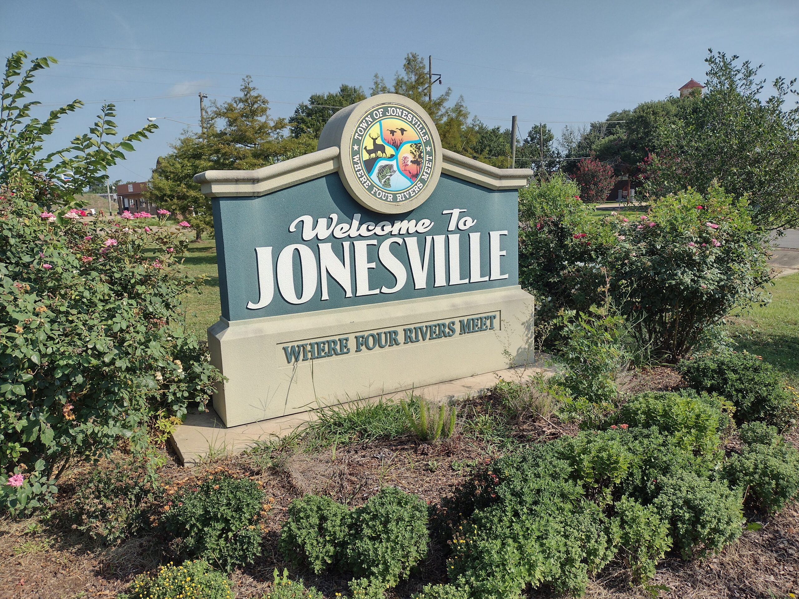
Perhaps the most unusual historical reconstruction in Louisiana is similarly positioned, not atop a tunnel, but over a bridge at the entrance to the Catahoula Parish town of Jonesville. The bridge crosses the Black River at a hydrologically unusual spot, one that is relevant to our story.
Just upriver, three rivers — the Ouachita, Tensas and Little, plus a bayou named Haha — merge to form the Black River, which then flows south to join the Red River. Further downriver, the Red flows into the Mississippi at the complex Atchafalaya distributary region known as Old River, after which the twin outlets make their way to the Gulf of Mexico.
From the Jonesville area, indigenous people could navigate northward all the way to Ouachita Mountains of Arkansas, and down to the vast and ecologically right coastal plain of Louisiana, all the while trading with various tribes of diverse geophysical regions.
What this area did not have, however, was sufficient topography to protect from high water. To be sure, there were loess deposits to the west and east — that is, wind-blown silt from the Ice Age, which blanketed the area in fine sediment and created bluffs like the Bastrop Hills to the northwest and Natchez, Miss., to the east. But among the braided channels of the Mississippi River and its affiliated waterways, spring freshets washed away the loess, leaving a wide, flat, flood-prone valley with few inhabitable perches.
Native people understood this valuable, but risky geography, and fixed the disparity by creating their own topography. During 400 to 700 A.D., tribes here built a remarkable series of terraced platform mounds, the largest of which was located here near the four-way confluence, 160 feet by 250 feet at its base and rising 82 feet high. In a 2009 American Archeology article by Concordia Sentinel journalist Stanley Nelson, Louisiana archaeologist Jon Gibson described the features as “one of the largest mound complexes in America, and the Great Mound [as] one of the tallest structures ever built in pre-Columbian America, which proves its local and regional importance.” More than just an elevated perch, the mounds had ceremonial purposes as well, making them genuine structures, with designs and purposes.
Like those of the much older and larger Poverty Point archeological site in West Carroll Parish, which originated roughly 3,700 years ago, the mounds at Jonesville are something of a mystery in terms of their construction and abandonment. Structurally, they endured into colonial times in good condition, earning the notice as well as the utilization of early Europeans.
One colonial settler, a ferry operator named Monsieur Cades, encountered the explorers William Dunbar and George Hunter during their Louisiana Purchase expedition — the “Lewis and Clark” of the south. Cades ferried travelers in transit between Natchez and Fort Miró (now Monroe), and according to Hunter (writing in October 1804), Cades “lives on an Indian mound about an acre in extent which is the only place near him that is not overflowed in the great freshes, & he seems to express a satisfaction that he has no bad neighbors. The ground here[,] if it were to be defended by a dike or Bank would be inexhaustibly fertile.”
A settlement developed around the upraised ferry landing under the name of Trinity, for the triple confluence. But limited flood protection stunted the community’s growth, as did a bitter family feud during the 1850s and 1860s.
In 1871, Laura Stewart Jones, the titleholder of an old Spanish land grant who had been left widowed by feud violence, had an area platted across from the older settlement of Trinity. It fronted the fourth named river discharging from the triple confluence, the Black.
The new community was named Troyville in 1878, gained economic relevance when the Natchez & Red River Railroad came through in 1883, and got renamed “Jonesville” in 1888 in honor of Laura Stewart Jones, one of the few Louisiana towns named for a female founder. By 1914, Jonesville had, according to historian Alcée Fortier, “a bank, several stores, 2 hotels, good schools, a saw and shingle mill, a money order postoffice, and a population of 287.”
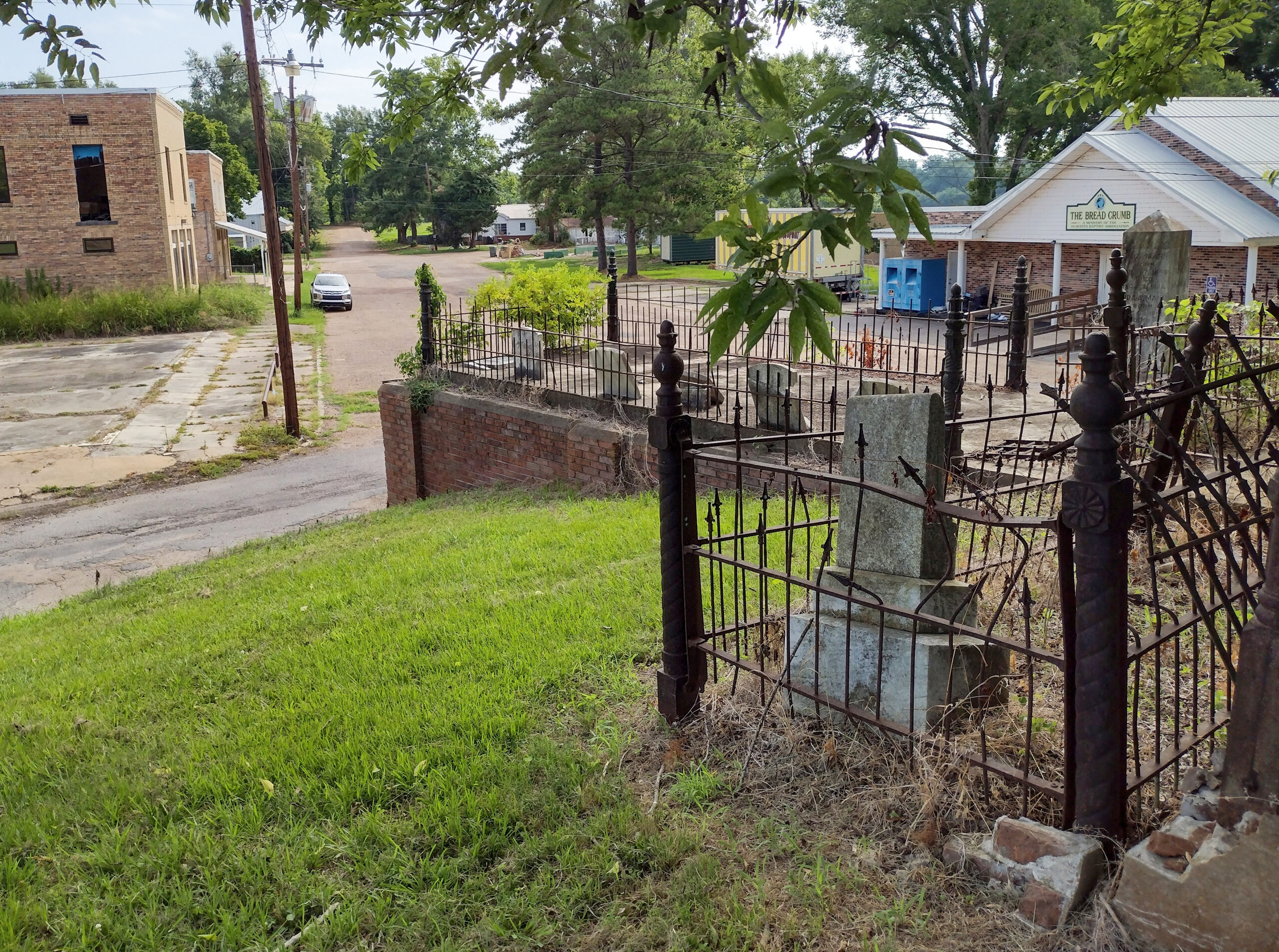
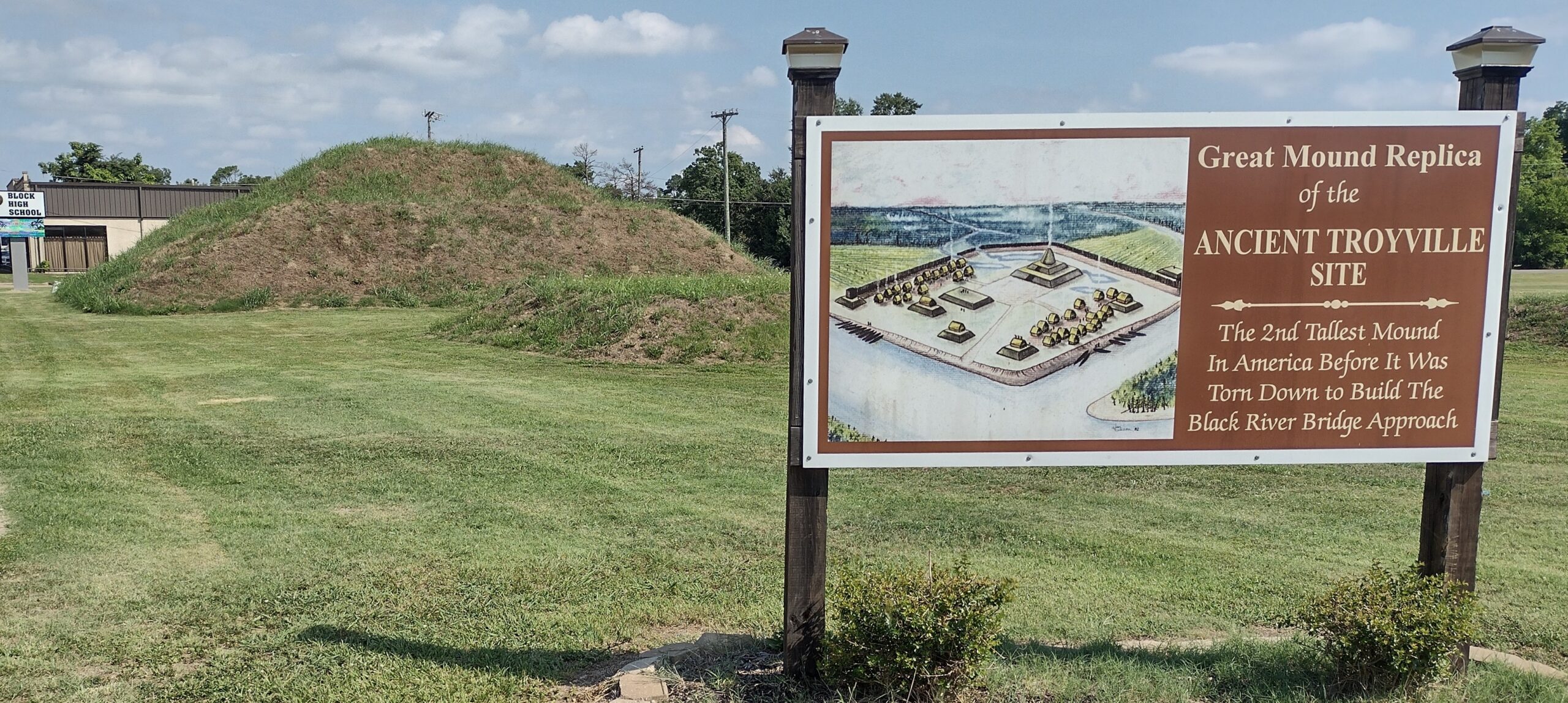
Photo 1: Methodist Cemetery on Indian Mound in Jonesville. Photo 2: Reconstructed Troyville Earthworks. Photos by Richard Campanella.
Jonesville and Trinity might have grown into a sizeable city had the area had more flood protection than that afforded by what had become known as the Troyville Earthworks. In 1946, Jonesville’s 2000 residents finally got the white man’s answer to the Indians’ mounds: a “ring levee,” manmade embankments encircling the low-lying town to keep Black River water at bay, like an island in reverse. But by then, the four rivers had lost their commercial importance to railroads, while railroads had lost cargo and passengers to vehicles on new highways — including one rammed right through the heart of Jonesville.
In 1931, Smithsonian Institution archeologist Winslow M. Walker had been conducting research in the area when he heard rumor of construction activity near the Troyville Earthworks. “When I got there, I found the largest and most important mound leveled by highway workers,” he wrote in a report later that year. “What was left in the debris indicates that the loss to science was inestimable.”
What remained were only three vertical feet of the main Troyville Earthworks, on aptly named Mound Street, plus a series of smaller mounds by Front Street, one of which has long been used as the Old Methodist Church Cemetery. Archeological research by Earth Works in 2005-2006 revealed numerous other prehistoric artifacts lying below the surface, including hearths, pits and middens, evidencing a substantial village with a growing population.
Into the 21st century, Jonesville proudly billed itself as the town “Where Four Rivers Meet,” according to the entrance sign on State Highway 94. Throughout the community may be found entities with names such as Four Rivers Park, Four Rivers Masonic Lodge, Four Rivers Insurance and Four Rivers Home Health.
But locals knew their truly distinguishing attribute had been the Grand Mound, an artifact of national importance until its thoughtless obliteration before preservationists even knew of the threat.
“Many people in Jonesville feel guilty about the destruction of the Great Mound,” wrote Stanley Nelson, citing local advocate Bill Atkins, a history buff and former state representative. “Everybody I talk to says it’s a shame they tore down the Indian mound,” recounted Atkins.
When time came to replace the bridge over the Black River, an opportunity arose to access the original soil displaced by the 1931 work. Mustering the rational of historical reconstruction, Atkins teamed with kindred spirits and envisioned rebuilding the Grand Mound, in form if not at full scale, at a spot right at the entrance to town.
According to Nelson, the team won the support of local and state officials, secured rights to the land from the local school board, attained the use of bulldozers from the Louisiana National Guard, and got technical support from engineers, for as they would all learn, building an earthen mound entails more than just mounding up earth.
Completed in 2011, the “Great Mound Replica of the Ancient Troyville Site” now stands at the entrance of Jonesville, as motorists cross the new bridge over the Black River. It surely ranks as one of Louisiana’s most unusual historical reconstruction projects, and, like Fort Condé in Mobile, succeeds in elevating a newcomer’s impression of Jonesboro.
As for local preservationists, they made a point of remembering the mistake of the 1931 destruction, lest it happen again. “The 2nd Tallest Mound in America,” reads the sign at the rebuilt Grand Mound, “Before It Was Torn Down to Build the Black River Bridge Approach.”
Richard Campanella is a geographer with the Tulane School of Architecture and author of The West Bank of Greater New Orleans; Cityscapes of New Orleans; Bourbon Street: A History; and other books. Campanella may be reached through richcampanella.com, [email protected], or @nolacampanella on Twitter.