
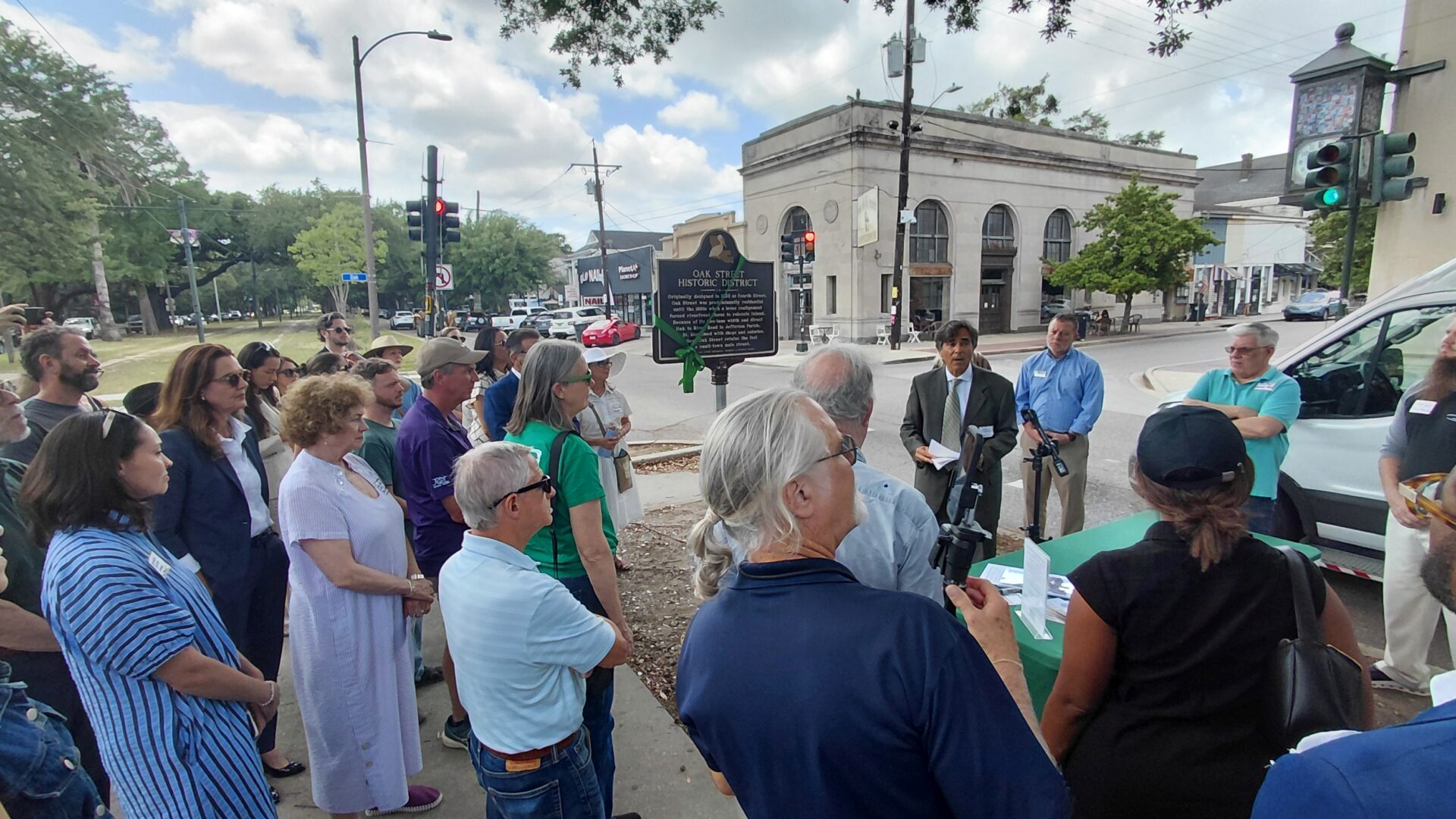
“Today, Oak Street retains the feel of a small-town main street.”
So reads the closing line of the historical plaque installed by the Oak Street Merchants, Residents and Property Owners organization. It perfectly captures the enduring character of Oak Street—a place whose small-town atmosphere has deep roots stretching back centuries.
From Natural Levee to Plantation
Long before Oak Street existed, this area was part of a natural Mississippi River levee lined with oak, sweetgum, sycamore and locust trees. Elevated enough to avoid most swampy conditions yet occasionally flooded by the river, the land was home to Indigenous peoples including the Annochy, Acolapissa, Quinapisa and Mugulasha. They referred to this area as Chapitoulas, meaning either “sharp river bend” or a fishing place for choupic (mudfish).
Following the founding of New Orleans in 1718, the French colonial government granted large land concessions for agricultural production. In 1719, city founder Jean Baptiste Le Moyne, Sieur de Bienville, claimed much of present-day Uptown New Orleans, including the future Carrollton area. Over time, however, he was forced to sell or lease these lands.
By the mid-1700s, the property belonged to the LaFrénière family, whose plantation was worked by enslaved laborers. After Nicolas LaFrénière led the failed 1768 rebellion against Spanish rule, he was executed, and his family’s property was confiscated.
The land eventually passed to the Lebreton family before being purchased in 1781 by Barthelemy Daniel de Macarty. Under his son, Jean-Baptiste Macarty, the plantation became one of Louisiana’s early successful sugar plantations following Étienne de Boré’s breakthrough sugar refining experiments in 1795. By the early nineteenth century, the Macarty Plantation stretched more than a mile along the Mississippi River and deep into the backswamp.
The Birth of Carrollton
As New Orleans rapidly expanded during the early 1800s, nearby plantations were subdivided into new neighborhoods known as faubourgs. Unlike those developments closer to the city, the Macarty Plantation remained isolated nearly two miles upriver.
That isolation became an advantage.
In 1831, the Macarty family sold the plantation to a group of investors that included the New Orleans Canal and Banking Company. Their vision was to create an independent country town connected to New Orleans by two exciting new transportation systems: a canal and a railroad.
German engineer Charles F. Zimpel was hired in 1833 to design both the New Orleans & Carrollton Rail Road and the street plan for the new town of Carrollton, named for General William Carroll, whose Kentucky militia camped nearby before the Battle of New Orleans.
Zimpel’s original plan looked very different from today’s neighborhood. Carrollton’s blocks were four times larger than modern city blocks, and today’s Oak Street was originally called Fourth Street.
How Oak Street Got Its Name
When the neighboring community of Greenville was subdivided in 1836, surveyors named one of its principal streets “Oak Street,” reflecting the area’s wooded landscape and complementing nearby streets such as Pine and Walnut.
Although Carrollton continued to call the roadway Fourth Street for decades, that changed after the community was annexed into New Orleans in 1874.
In 1894, the city undertook a major street renaming effort to eliminate duplicate street names. Fourth Street through Carrollton officially became an extension of Greenville’s Oak Street, while another Oak Street downtown was renamed Orchid Street to avoid confusion.
That same year, New Orleans adopted its modern house numbering system, giving Oak Street the familiar addresses it still has today.
A Growing Commercial Corridor
During Carrollton’s early years, Fourth Street remained primarily residential. Commerce centered along Levee Street (roughly present-day Leake Avenue), near the riverfront, railroad and Carrollton Market.
Several developments changed that pattern in the late nineteenth century. Carrollton was annexed into New Orleans in 1874, Levee Street’s commercial district was disrupted by river levee realignment in 1891, the St. Charles Streetcar Line was electrified in 1893, and Oak Street occupied a central location within the expanding neighborhood.
By the early 1900s, Oak Street had begun evolving into the commercial district residents recognize today.
The Southport Shuttle
One unique feature helped shape Oak Street’s future: the 8100–8800 blocks were approximately ten feet wider than surrounding streets.
That extra width allowed the construction of the Southport Shuttle streetcar line in 1900. The line connected South Carrollton Avenue with Southport along the river, bringing additional customers directly to Oak Street businesses.
Although the Southport Shuttle ended service in 1929, the unusually wide roadway proved equally valuable in the automobile era by accommodating two-way traffic and on-street parking.
Planning Preserves Character
Oak Street’s commercial identity developed naturally through local business growth rather than city planning. When New Orleans established its City Planning Commission in 1923 and adopted its first zoning ordinance in 1929, planners largely formalized what had already emerged.
Because Oak Street had transitioned gradually from residential to mixed commercial use, both building types remain visible today, creating the architectural variety that gives the corridor much of its distinctive charm.
Oak Street Today
Oak Street remains one of New Orleans’ most distinctive neighborhood commercial corridors. It reflects its unique evolution—from natural levee to plantation, from independent town to city neighborhood—while maintaining the welcoming scale and walkability that inspired the historical plaque’s closing observation.
It is simultaneously traditional and contemporary, local yet cosmopolitan, tucked into its neighborhood while connected to the broader city. More than a century after becoming Oak Street, it still feels exactly as it was described:
“A city shopping and dining district with the look and feel of a small-town main street.”
About the Author
Richard Campanella is a geographer with the Tulane School of Architecture and Built Environment. In 2021, the Oak Street Merchants, Residents and Property Owners organization commissioned him to research and write a history of Oak Street, from which this article was abridged. He also authored the text for the Oak Street historical plaque.
Campanella is the author of Draining New Orleans, The West Bank of Greater New Orleans, Bienville’s Dilemma, and numerous other books on New Orleans history and geography. He may be reached through richcampanella.com, by email at [email protected], or on X @nolacampanella.